Wooden Bathymetric Water Depth Charts For Various Bodies Of Water

By Ryan on 04/08/2015 8:43 AM

Wooden Bathymetric Water Depth Charts For Various Bodies Of Water

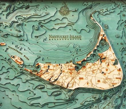
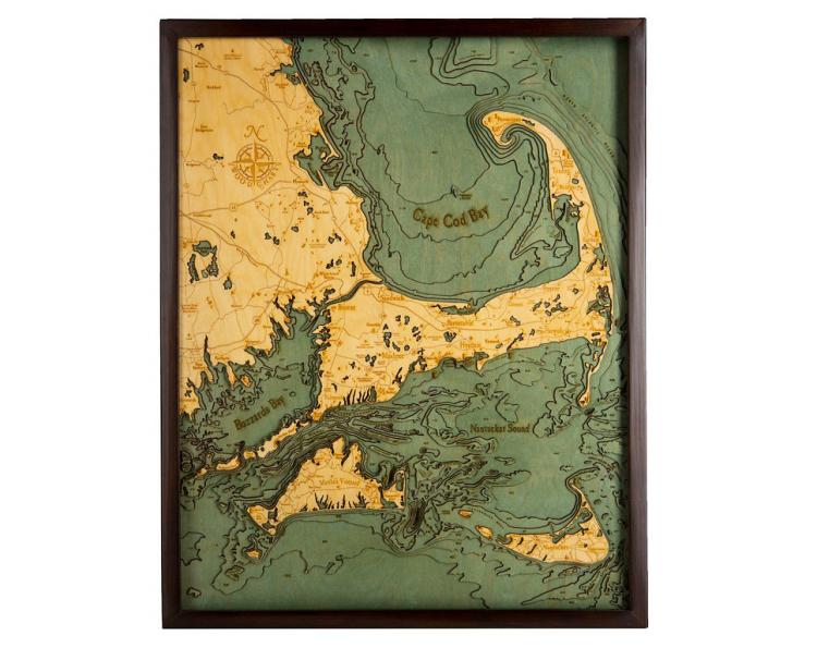
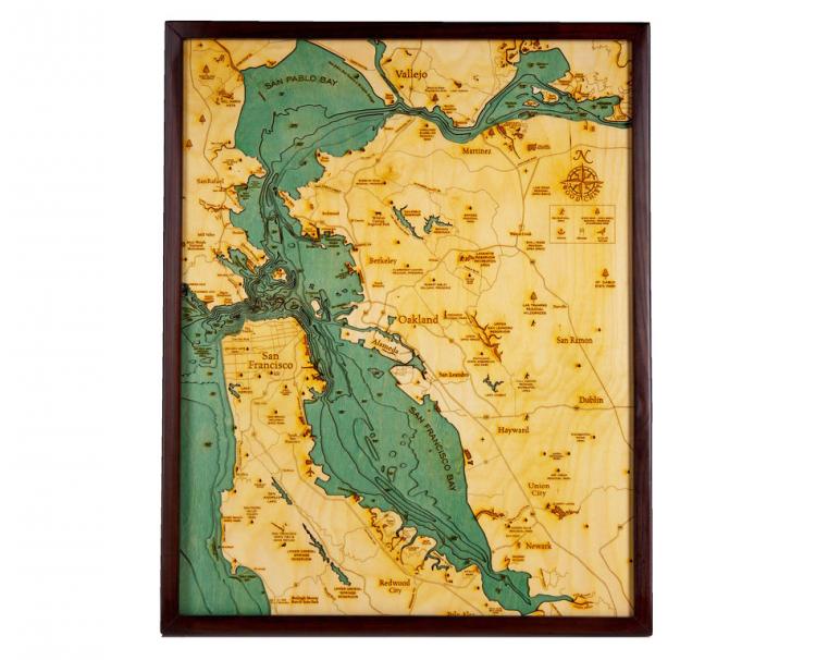
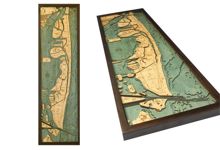
Designed and created by Below The Boat, these wooden bathymetric charts (the water equivalent of a topographic charts) feature various areas around the world and make a map of the depth levels on the sea floor around it, and would make the perfect gift idea for sailors, oceanographers, surfers, or really anyone who loves the sea. The maps are created by laser-cutting each layer using Baltic birch wood and then gluing together each piece of wood to create a beautiful map with visual depth.

These wooden Bathymetric charts feature areas such as Nantucket Island, Cape Cod, San Francisco BayManhattan, the Great LakesMiami Beach, and a ton of other locations.

Bathymetric Wooden Layered Chart Map - Cape Cod

Bathymetric Wooden Layered Chart Map - San Francisco

Bathymetric Wooden Layered Chart Map - Great Lakes

Bathymetric Wooden Layered Chart Map - Miami Beach

Bathymetric Wooden Layered Chart Map - Manhattan

Bathymetric Wooden Layered Chart Map

Bathymetric Wooden Layered Chart Map - Gulf

Bathymetric Wooden Layered Chart Map

Bathymetric Wooden Layered Chart Map - Key West

Bathymetric Wooden Layered Chart Map - Chicago

Odditymall.com is a participant in the Amazon Services LLC Associates Program, an affiliate advertising program designed to provide a way for websites to earn advertising revenues by advertising and linking to Amazon.com